Skip Navigation Links
NOAA NOAA United States Department of Commerce

NHC Graphical Outlook Archive


« Earliest Available         ‹ Earlier         Later ›         Latest Available »
GIS Shapefiles
Central Pacific Eastern Pacific Atlantic

View 2-Day Graphical Tropical Weather Outlook
Click for Eastern North Pacific Click for Eastern North Pacific

Tropical Weather Outlook Text

ZCZC HFOTWOCP ALL
TTAA00 PHFO DDHHMM

Tropical Weather Outlook
NWS Central Pacific Hurricane Center Honolulu HI
200 AM HST Thu Sep 17 2020

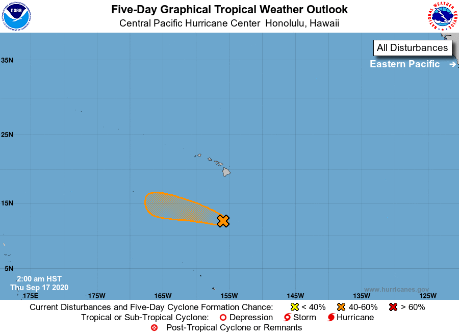
For the central North Pacific...between 140W and 180W:

1. Shower and thunderstorm activity associated with an elongated 
area of low pressure around 500 miles south of Hilo, Hawaii, has 
become better organized over the last several hours. Environmental 
conditions will be marginally conducive for development today as 
the system moves west-northwestward at 10 to 15 mph, before 
conditions become hostile and chances for development decrease 
tonight through the weekend.
* Formation chance through 48 hours...medium...40 percent.
* Formation chance through 5 days...medium...40 percent.

Elsewhere, no tropical cyclones are expected during the next 5 days.

Forecaster Jelsema


List of Atlantic Outlooks (May 2023 - present)
List of East Pacific Outlooks (May 2023 - present)
List of Central Pacific Outlooks (May 2023 - present)
List of Atlantic Outlooks (July 2014 - April 2023)
List of East Pacific Outlooks (July 2014 - April 2023)
List of Central Pacific Outlooks (June 2019 - April 2023)
List of Atlantic Outlooks (June 2009 - June 2014)
List of East Pacific Outlooks (June 2009 - June 2014)