ZCZC HFOTWOCP ALL
TTAA00 PHFO DDHHMM
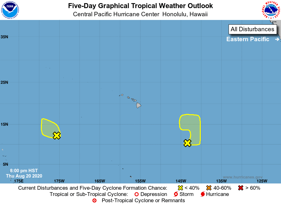
Tropical Weather Outlook
NWS Central Pacific Hurricane Center Honolulu HI
800 PM HST Thu Aug 20 2020
For the central North Pacific...between 140W and 180W:
1. An elongated area of low pressure located around 1350 miles
west-southwest of Honolulu, is producing disorganized shower and
thunderstorm activity. Environmental conditions are expected to
remain unfavorable for development as the system moves slowly
northwest during the next few days.
* Formation chance through 48 hours...low...10 percent.
* Formation chance through 5 days...low...10 percent.
2. A broad area of low pressure located around 1000 miles southeast of
Hilo, Hawaii, is producing very little shower and thunderstorm
activity. Environmental conditions appear marginally conducive for
development as this system moves slowly northeast during the next
few days.
* Formation chance through 48 hours...low...10 percent.
* Formation chance through 5 days...low...20 percent.
Elsewhere, no tropical cyclones are expected during the next 5 days.
Forecaster Jelsema