Skip Navigation Links
NOAA NOAA United States Department of Commerce

NHC Graphical Outlook Archive


« Earliest Available         ‹ Earlier         Later ›         Latest Available »
GIS Shapefiles
Central Pacific Eastern Pacific Atlantic

View 2-Day Graphical Tropical Weather Outlook
Click for Eastern North Pacific Click for Eastern North Pacific

Tropical Weather Outlook Text

ZCZC HFOTWOCP ALL
TTAA00 PHFO DDHHMM

Tropical Weather Outlook
NWS Central Pacific Hurricane Center Honolulu HI
800 AM HST Tue Aug 18 2020

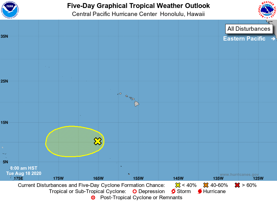
For the central North Pacific...between 140W and 180W:

1. An area of low pressure about 875 miles southwest of Honolulu, 
Hawaii is producing some showers and thunderstorms, but lacks 
significant organization. Environmental conditions are not 
expected to be conducive for development over the next few days, 
and only a small chance of development exists as the system 
continues westward and nears the Date Line later in the week.
* Formation chance through 48 hours...low...near 0 percent.
* Formation chance through 5 days...low...10 percent.

Elsewhere, no tropical cyclones are expected during the next 5 days.

Forecaster M Ballard


List of Atlantic Outlooks (May 2023 - present)
List of East Pacific Outlooks (May 2023 - present)
List of Central Pacific Outlooks (May 2023 - present)
List of Atlantic Outlooks (July 2014 - April 2023)
List of East Pacific Outlooks (July 2014 - April 2023)
List of Central Pacific Outlooks (June 2019 - April 2023)
List of Atlantic Outlooks (June 2009 - June 2014)
List of East Pacific Outlooks (June 2009 - June 2014)