Skip Navigation Links
NOAA NOAA United States Department of Commerce

NHC Graphical Outlook Archive


« Earliest Available         ‹ Earlier         Later ›         Latest Available »
GIS Shapefiles
Central Pacific Eastern Pacific Atlantic

View 2-Day Graphical Tropical Weather Outlook
Click for Eastern North Pacific Click for Eastern North Pacific

Tropical Weather Outlook Text

ZCZC HFOTWOCP ALL
TTAA00 PHFO DDHHMM

Tropical Weather Outlook
NWS Central Pacific Hurricane Center Honolulu HI
800 PM HST Sun Aug 16 2020

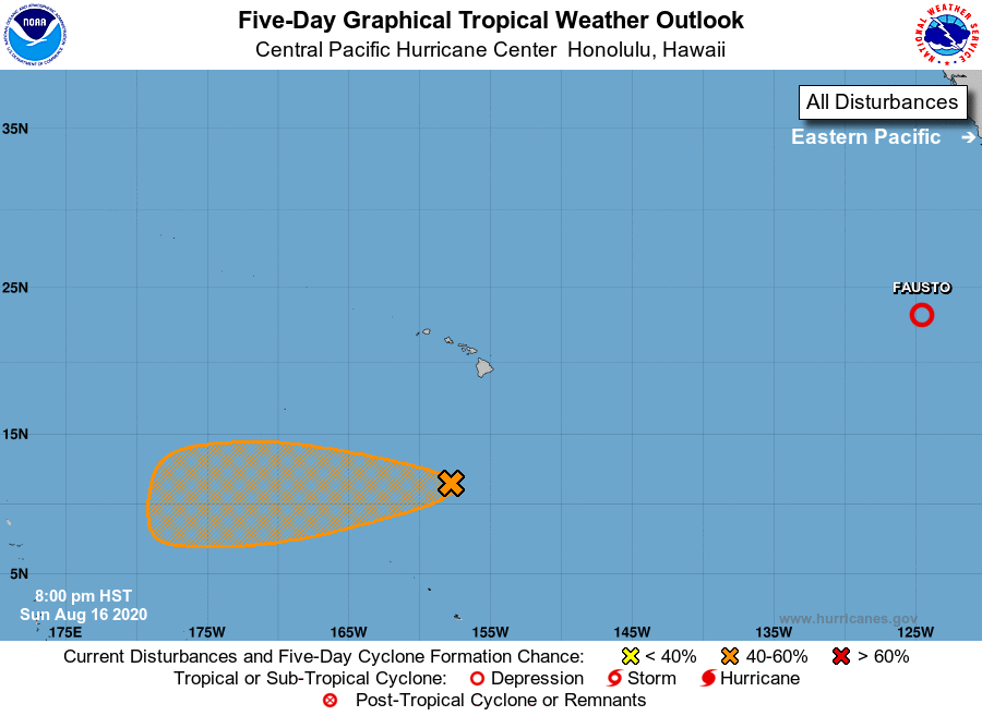
For the central North Pacific...between 140W and 180W:

1. A nearly stationary area of low pressure about 700 miles south of 
Honolulu, Hawaii is producing disorganized showers and 
thunderstorms, and lacks significant organization. Environmental 
conditions are expected to be marginally conducive for gradual 
development over the next couple of days as the system moves toward 
the west slowly.
* Formation chance through 48 hours...low...30 percent.
* Formation chance through 5 days...medium...50 percent.

Elsewhere, no tropical cyclones are expected during the next 5 days.

Forecaster Powell


List of Atlantic Outlooks (May 2023 - present)
List of East Pacific Outlooks (May 2023 - present)
List of Central Pacific Outlooks (May 2023 - present)
List of Atlantic Outlooks (July 2014 - April 2023)
List of East Pacific Outlooks (July 2014 - April 2023)
List of Central Pacific Outlooks (June 2019 - April 2023)
List of Atlantic Outlooks (June 2009 - June 2014)
List of East Pacific Outlooks (June 2009 - June 2014)