Skip Navigation Links
NOAA NOAA United States Department of Commerce

NHC Graphical Outlook Archive


« Earliest Available         ‹ Earlier         Later ›         Latest Available »
GIS Shapefiles
Central Pacific Eastern Pacific Atlantic

View 2-Day Graphical Tropical Weather Outlook
Click for Eastern North Pacific Click for Eastern North Pacific

Tropical Weather Outlook Text

ZCZC HFOTWOCP ALL
TTAA00 PHFO DDHHMM

Tropical Weather Outlook
NWS Central Pacific Hurricane Center Honolulu HI
200 PM HST Sat Aug 15 2020

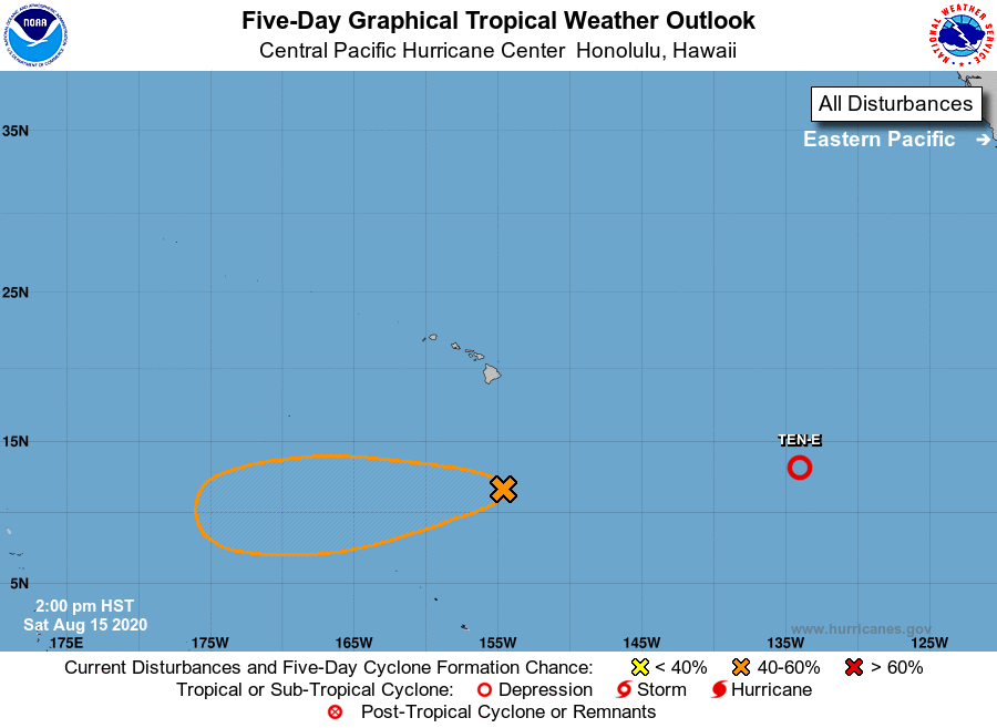
For the central North Pacific...between 140W and 180W:

1. An area of low pressure is located around 545 miles south of Hilo, 
Hawaii. Shower and thunderstorm activity with the feature has 
decreased over the past six hours. Environmental conditions 
are expected to become more conducive for development during 
the next few days and a tropical depression may form later this 
weekend or early next week as the system moves steadily west at 
around 10 mph.
* Formation chance through 48 hours...medium...50 percent.
* Formation chance through 5 days...medium...60 percent.

Elsewhere, no tropical cyclones are expected during the next 5 days.

Forecaster Kinel


List of Atlantic Outlooks (May 2023 - present)
List of East Pacific Outlooks (May 2023 - present)
List of Central Pacific Outlooks (May 2023 - present)
List of Atlantic Outlooks (July 2014 - April 2023)
List of East Pacific Outlooks (July 2014 - April 2023)
List of Central Pacific Outlooks (June 2019 - April 2023)
List of Atlantic Outlooks (June 2009 - June 2014)
List of East Pacific Outlooks (June 2009 - June 2014)