ZCZC HFOTWOCP ALL
TTAA00 PHFO DDHHMM
Tropical Weather Outlook
NWS Central Pacific Hurricane Center Honolulu HI
200 PM HST Tue Aug 11 2020
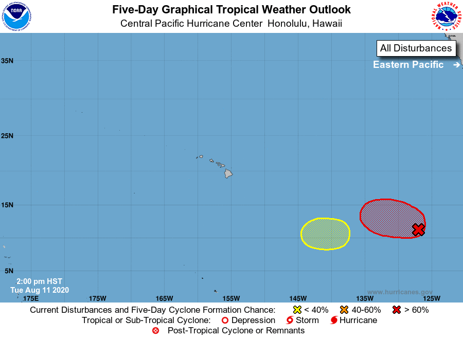
For the central North Pacific...between 140W and 180W:
1. Recent satellite wind data indicate that the area of low pressure
located about 1900 miles east-southeast of Hilo, Hawaii remains
elongated. The associated shower and thunderstorm activity is
currently disorganized, but environmental conditions are expected to
be conducive for additional development, and a tropical depression
is likely to form within the next few days. The system is not
expected to move as quickly westward as originally forecast, and a
slower westward to west-northwestward motion is now anticipated over
the next several days.
* Formation chance through 48 hours...medium...50 percent.
* Formation chance through 5 days...high...80 percent.
2. Another area of disturbed weather is forecast to form about
1750 miles east-southeast of Hilo, Hawaii within the next couple
of days. Some subsequent gradual development of this system is
possible later this week while the system moves slowly westward
into the Central Pacific basin.
* Formation chance through 48 hours...low...near 0 percent.
* Formation chance through 5 days...low...30 percent.
Elsewhere, no tropical cyclones are expected during the next 5 days.
Forecaster M Ballard