Skip Navigation Links
NOAA NOAA United States Department of Commerce

NHC Graphical Outlook Archive


« Earliest Available         ‹ Earlier         Later ›         Latest Available »
GIS Shapefiles
Central Pacific Eastern Pacific Atlantic

View 2-Day Graphical Tropical Weather Outlook
Click for Eastern North Pacific Click for Eastern North Pacific

Tropical Weather Outlook Text

ZCZC HFOTWOCP ALL
TTAA00 PHFO DDHHMM

Tropical Weather Outlook
NWS Central Pacific Hurricane Center Honolulu HI
200 PM HST Tue Jun 23 2020

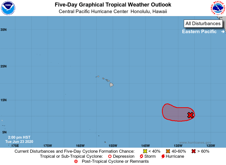
For the central North Pacific...between 140W and 180W:

1. A nearly stationary area of low pressure is located about 1700
miles east-southeast of Hilo, Hawaii.  Although this disturbance has
a well-defined circulation, it is producing only limited shower
activity.  Environmental conditions are expected to support the
redevelopment of thunderstorms and the system is likely to become a
tropical depression during the next few days.  The system is
expected to move slowly westward and may enter the central Pacific
this weekend.
* Formation chance through 48 hours...medium...60 percent.
* Formation chance through 5 days...high...70 percent.

Forecaster Wroe


List of Atlantic Outlooks (May 2023 - present)
List of East Pacific Outlooks (May 2023 - present)
List of Central Pacific Outlooks (May 2023 - present)
List of Atlantic Outlooks (July 2014 - April 2023)
List of East Pacific Outlooks (July 2014 - April 2023)
List of Central Pacific Outlooks (June 2019 - April 2023)
List of Atlantic Outlooks (June 2009 - June 2014)
List of East Pacific Outlooks (June 2009 - June 2014)