ZCZC HFOTWOCP ALL
TTAA00 PHFO DDHHMM
Tropical Weather Outlook
NWS Central Pacific Hurricane Center Honolulu HI
200 PM HST Wed Sep 18 2019
For the central North Pacific...between 140W and 180W:
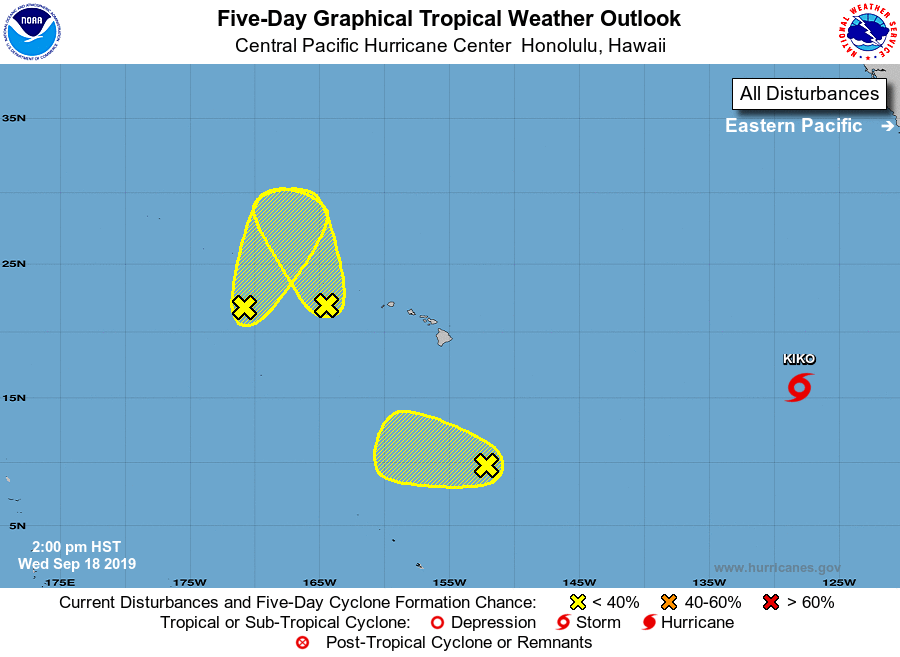
1. Showers and thunderstorms are associated with an area of low
pressure around 300 miles west of Kauai. Environmental conditions
are only marginally conducive for some development through tonight
as the system moves toward the north-northwest. Conditions are
expected to become even less conducive into Thursday as the low
interacts with another disturbance just to its west. As these
disturbances combine, locally gusty winds and heavy rain are
expected for portions of the Papahanaumokuakea Marine National
Monument over the next several days.
* Formation chance through 48 hours...low...20 percent.
* Formation chance through 5 days...low...20 percent.
2. A disorganized area of showers and thunderstorms is associated with
an elongated area of low pressure around 700 miles west of Kauai.
This system is expected to slowly move north-northeast into more
unfavorable environmental conditions through tonight as it interacts
with another area of low pressure just to its east. As these
disturbances combine, locally gusty winds and heavy rain are
expected for portions of the Papahanaumokuakea Marine National
Monument over the next several days.
* Formation chance through 48 hours...low...near 0 percent.
* Formation chance through 5 days...low...10 percent.
3. An elongated area of low pressure is around 700 miles
south-southeast of Hilo, Hawaii. Environmental conditions are not
very conducive for development into a tropical system and will
become increasingly less so over the next several days.
* Formation chance through 48 hours...low...near 0 percent.
* Formation chance through 5 days...low...near 0 percent.
Elsewhere, no tropical cyclones are expected during the next 5 days.
Forecaster TS