Skip Navigation Links
NOAA NOAA United States Department of Commerce

NHC Graphical Outlook Archive


« Earliest Available         ‹ Earlier         Later ›         Latest Available »
GIS Shapefiles
Central Pacific Eastern Pacific Atlantic

View 2-Day Graphical Tropical Weather Outlook
Click for Eastern North Pacific Click for Eastern North Pacific

Tropical Weather Outlook Text

ZCZC HFOTWOCP ALL
TTAA00 PHFO DDHHMM

Tropical Weather Outlook
NWS Central Pacific Hurricane Center Honolulu HI
200 AM HST Thu Aug 15 2019

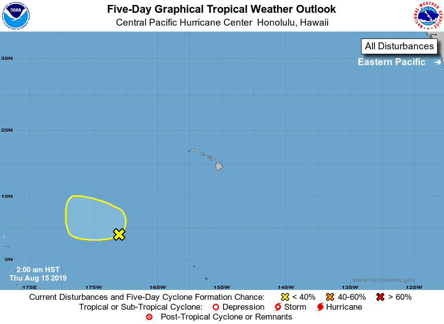
For the central North Pacific...between 140W and 180W:

1. Showers and thunderstorms remain disorganized along a trough of low
pressure located some 1250 miles southwest of Oahu. Some development
of the system is possible as it moves west-northwestward at around
10 mph.
* Formation chance through 48 hours...low...near 20 percent.
* Formation chance through 5 days...low...20 percent.

Elsewhere, no tropical cyclones are expected during the next 5 days.

Forecaster Lau


List of Atlantic Outlooks (May 2023 - present)
List of East Pacific Outlooks (May 2023 - present)
List of Central Pacific Outlooks (May 2023 - present)
List of Atlantic Outlooks (July 2014 - April 2023)
List of East Pacific Outlooks (July 2014 - April 2023)
List of Central Pacific Outlooks (June 2019 - April 2023)
List of Atlantic Outlooks (June 2009 - June 2014)
List of East Pacific Outlooks (June 2009 - June 2014)