ZCZC MIATWOAT ALL
TTAA00 KNHC DDHHMM
Tropical Weather Outlook
NWS National Hurricane Center Miami FL
800 PM EDT Sun Oct 23 2022
For the North Atlantic...Caribbean Sea and the Gulf of Mexico:
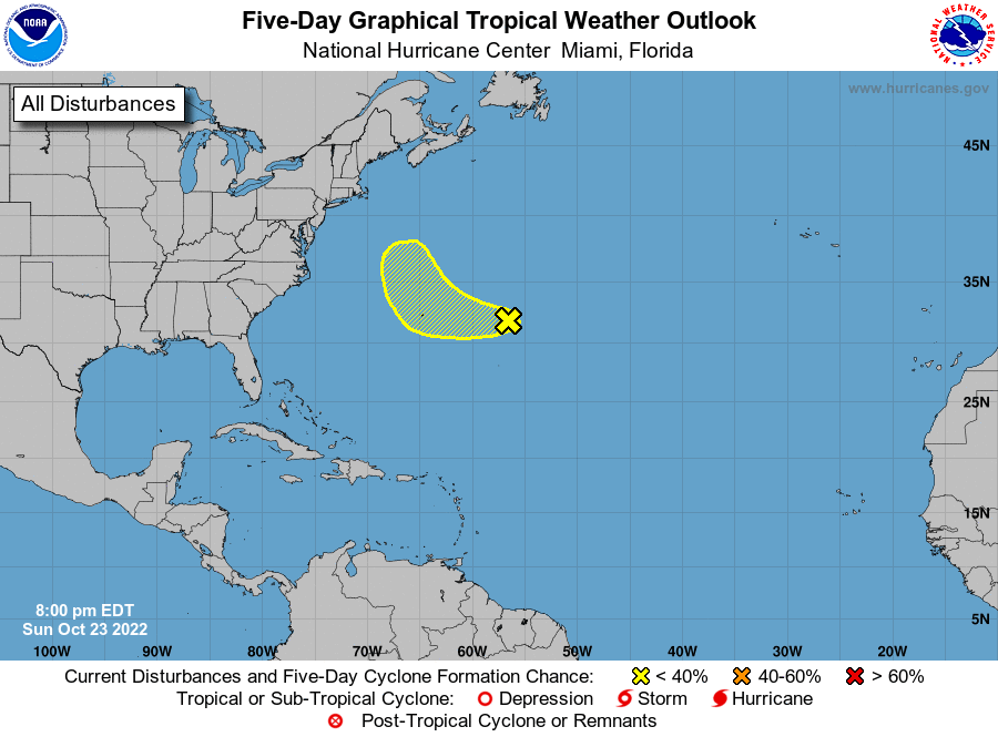
1. Central Subtropical Atlantic:
Shower and thunderstorm activity remains disorganized in
association with a sharp trough of low pressure located less than
500 miles east of Bermuda. Environmental conditions are only
marginally conducive for some tropical or subtropical development of
this system over the next couple of days while it moves generally
west-northwestward at 15 to 20 mph, passing near Bermuda on Monday
night. Later this week, the system will turn northward towards the
cooler waters of the northwestern Atlantic, and further development
is not anticipated by that time as upper-level winds increase.
* Formation chance through 48 hours...low...10 percent.
* Formation chance through 5 days...low...10 percent.
Forecaster Papin