ZCZC MIATWOAT ALL
TTAA00 KNHC DDHHMM
Tropical Weather Outlook
NWS National Hurricane Center Miami FL
800 AM EDT Fri Oct 14 2022
For the North Atlantic...Caribbean Sea and the Gulf of Mexico:
Active Systems:
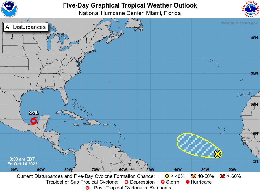
The National Hurricane Center is issuing advisories on Tropical
Storm Karl, located over the southwestern Gulf of Mexico.
1. Eastern Tropical Atlantic:
An area of disorganized showers and thunderstorms located several
hundred miles south-southwest of the Cabo Verde Islands is
associated with a tropical wave. Environmental conditions appear
marginally conducive for some gradual development during the next
few days while the system moves westward to west-northwestward at
about 10 mph. By early next week, environmental conditions are
forecast to become less favorable as the disturbance is expected to
move into an area of stronger upper-level winds.
* Formation chance through 48 hours...low...10 percent.
* Formation chance through 5 days...low...20 percent.
Forecaster Reinhart