ZCZC MIATWOAT ALL
TTAA00 KNHC DDHHMM
Tropical Weather Outlook
NWS National Hurricane Center Miami FL
200 AM EDT Thu Oct 13 2022
For the North Atlantic...Caribbean Sea and the Gulf of Mexico:
Active Systems:
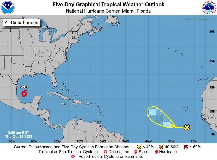
The National Hurricane Center is issuing advisories on Tropical
Storm Karl, located over the southwestern Gulf of Mexico.
1. Eastern Tropical Atlantic:
A tropical wave located several hundred miles to the south of the
Cabo Verde Islands is producing a broad area of showers and
thunderstorms. Environmental conditions appear marginally favorable
for some slow development of this system as it moves westward to
west-northwestward at 5-10 mph over the tropical Atlantic through
early next week.
* Formation chance through 48 hours...low...near 0 percent.
* Formation chance through 5 days...low...20 percent.
Forecaster Papin