ZCZC MIATWOAT ALL
TTAA00 KNHC DDHHMM
Tropical Weather Outlook
NWS National Hurricane Center Miami FL
200 AM EDT Tue Oct 11 2022
For the North Atlantic...Caribbean Sea and the Gulf of Mexico:
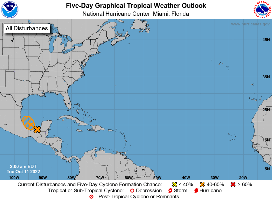
1. Southwest Gulf of Mexico:
A trough of low pressure over southeastern Mexico is producing a
large area of showers and thunderstorms over the Bay of Campeche
and adjacent land areas. This system is forecast to move slowly
northwestward over the southwestern Gulf of Mexico later this
morning. Environmental conditions are expected to conducive for
some development, and a tropical depression could from within the
next day or two while the system meanders over the southwestern Gulf
of Mexico. After that time, increasing upper-level winds are
likely to hinder additional development. Regardless of formation,
heavy rainfall is expected over portions of southern Mexico during
the next couple of days. An Air Force Reserve reconnaissance
aircraft is scheduled to investigate the disturbance this afternoon
if necessary.
* Formation chance through 48 hours...medium...40 percent.
* Formation chance through 5 days...medium...40 percent.
Forecaster Brown