ZCZC MIATWOAT ALL
TTAA00 KNHC DDHHMM
Tropical Weather Outlook
NWS National Hurricane Center Miami FL
200 PM EDT Thu Oct 6 2022
For the North Atlantic...Caribbean Sea and the Gulf of Mexico:
Active Systems:
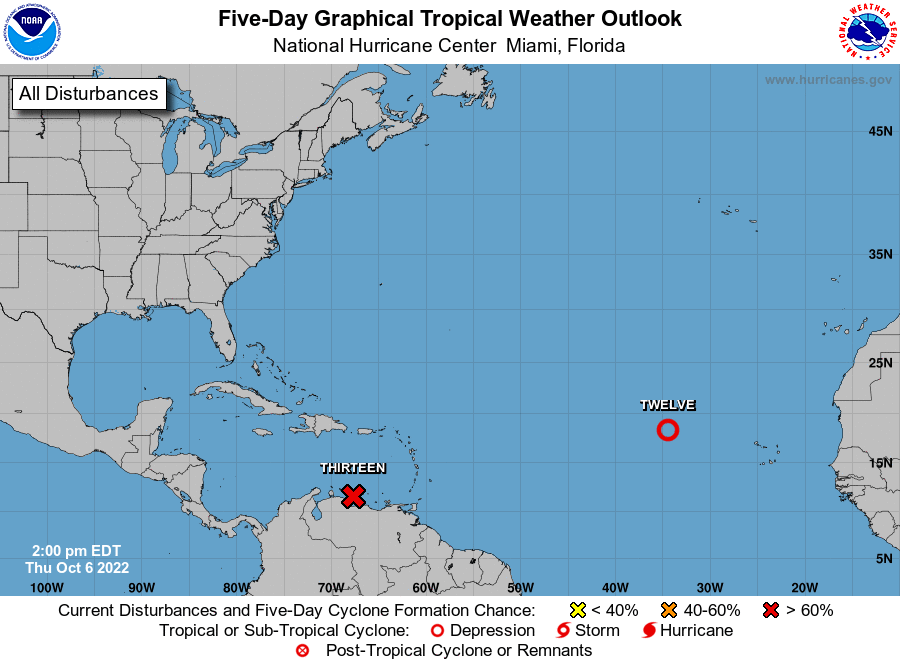
The National Hurricane Center is issuing advisories on Tropical
Depression Twelve, located about 700 miles west-northwest of the
Cabo Verde Islands.
Advisories have been initiated on Potential Tropical Cyclone
Thirteen, located over the south-central Caribbean Sea.
* Formation chance through 48 hours...high...near 100 percent.
* Formation chance through 5 days...high...near 100 percent.
&&
Public Advisories on Potential Tropical Cyclone Thirteen are issued
under WMO header WTNT33 KNHC and under AWIPS header MIATCPAT3.
Forecast/Advisories on Potential Tropical Cyclone Thirteen are
issued under WMO header WTNT23 KNHC and under AWIPS header
MIATCMAT3.
$$
Forecaster Berg
NNNN