ZCZC MIATWOAT ALL
TTAA00 KNHC DDHHMM
Tropical Weather Outlook
NWS National Hurricane Center Miami FL
200 AM EDT Sun Oct 2 2022
For the North Atlantic...Caribbean Sea and the Gulf of Mexico:
Active Systems:
The Weather Prediction Center has issued the last advisory on
Post-Tropical Cyclone Ian, located over southern Virginia.
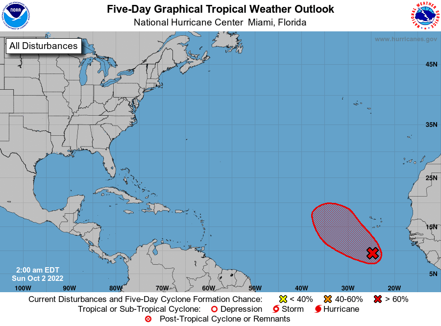
1. Eastern Tropical Atlantic:
Conventional imagery and satellite-derived wind data indicate that
shower activity associated with a tropical wave located several
a hundred miles south of the Cabo Verde Islands has changed little
since yesterday morning. Environmental conditions, however, are
forecast to be favorable for some gradual development during the
next several days. Therefore, a tropical depression is likely to
form during the early or middle part of next week while the system
moves westward, then turns northwestward or northward toward the
end of the week over the eastern tropical Atlantic.
* Formation chance through 48 hours...low...20 percent.
* Formation chance through 5 days...high...70 percent.
Forecaster Roberts