ZCZC MIATWOAT ALL
TTAA00 KNHC DDHHMM
Tropical Weather Outlook
NWS National Hurricane Center Miami FL
800 AM EDT Wed Sep 28 2022
For the North Atlantic...Caribbean Sea and the Gulf of Mexico:
Active Systems:
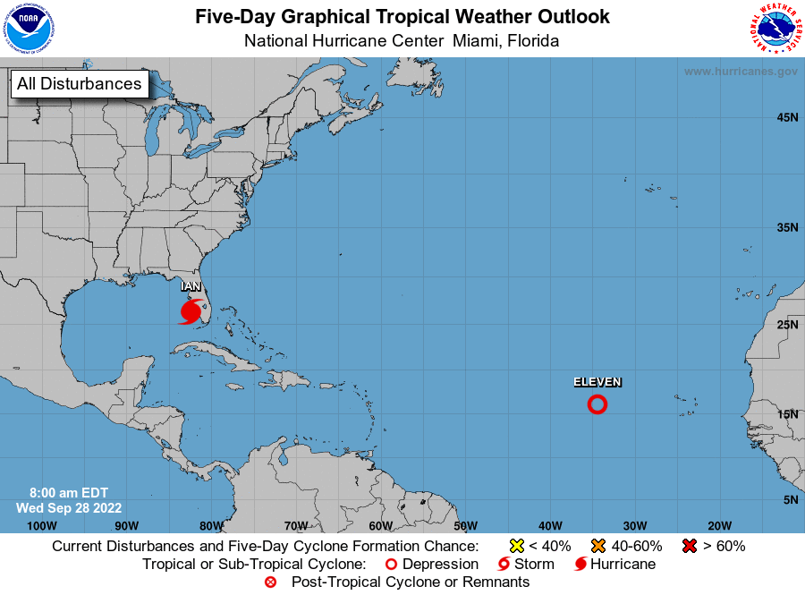
The National Hurricane Center is issuing advisories on Hurricane
Ian, located just off the coast of southwestern Florida.
1. Central Tropical Atlantic:
Showers and thunderstorms associated with an area of low pressure
located several hundred miles west of the Cabo Verde Islands have
become better organized over the last 24 hours. A short-lived
tropical depression or tropical storm is expected to form later
today as the system moves generally northward or north-northwestward
through the end of the week, remaining over the open central
Atlantic.
* Formation chance through 48 hours...high...90 percent.
* Formation chance through 5 days...high...90 percent.
Forecaster Papin