ZCZC MIATWOAT ALL
TTAA00 KNHC DDHHMM
Tropical Weather Outlook
NWS National Hurricane Center Miami FL
800 PM EDT Tue Sep 27 2022
For the North Atlantic...Caribbean Sea and the Gulf of Mexico:
Active Systems:
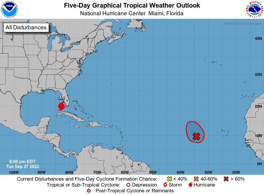
The National Hurricane Center is issuing advisories on Hurricane
Ian, located over the far southeastern Gulf of Mexico.
1. Central Tropical Atlantic:
Showers and thunderstorms associated with an area of low pressure
located several hundred miles west of the Cabo Verde Islands have
become better organized over the past several hours. Although
environmental conditions are expected to be marginally conducive for
development, only a slight increase in organization would result in
the formation of a short-lived tropical depression tonight or
tomorrow. Further development will become less likely by the end of
the week due to increasing upper-level winds. The disturbance is
forecast to meander for the next day or so and then turn
north-northwestward by Thursday.
* Formation chance through 48 hours...high...70 percent.
* Formation chance through 5 days...high...70 percent.
Forecaster D. Zelinsky