ZCZC MIATWOAT ALL
TTAA00 KNHC DDHHMM
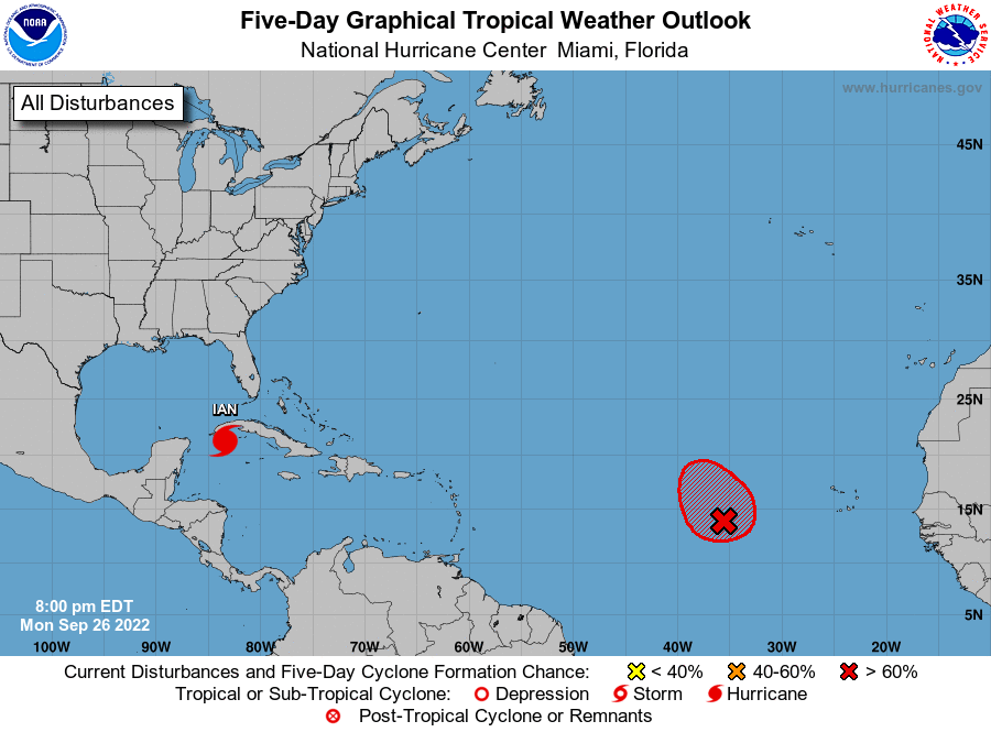
Tropical Weather Outlook
NWS National Hurricane Center Miami FL
800 PM EDT Mon Sep 26 2022
For the North Atlantic...Caribbean Sea and the Gulf of Mexico:
Active Systems:
The National Hurricane Center is issuing advisories on Hurricane
Ian, located over the northwestern Caribbean Sea.
1. Central Tropical Atlantic:
An area of low pressure located several hundred miles west of the
Cabo Verde Islands is producing showers and thunderstorms. While the
system has not become better organized today, environmental
conditions are expected to be sufficiently conducive for the system
to become a tropical depression during the next couple of days.
Further development will become less likely by the end of the week
due to strong upper-level winds. The disturbance is forecast to
meander for the next day or two and then turn north-northwestward by
early Thursday.
* Formation chance through 48 hours...high...70 percent.
* Formation chance through 5 days...high...70 percent.
Forecaster D. Zelinsky