ZCZC MIATWOAT ALL
TTAA00 KNHC DDHHMM
Tropical Weather Outlook
NWS National Hurricane Center Miami FL
800 PM EDT Sun Sep 25 2022
For the North Atlantic...Caribbean Sea and the Gulf of Mexico:
Active Systems:
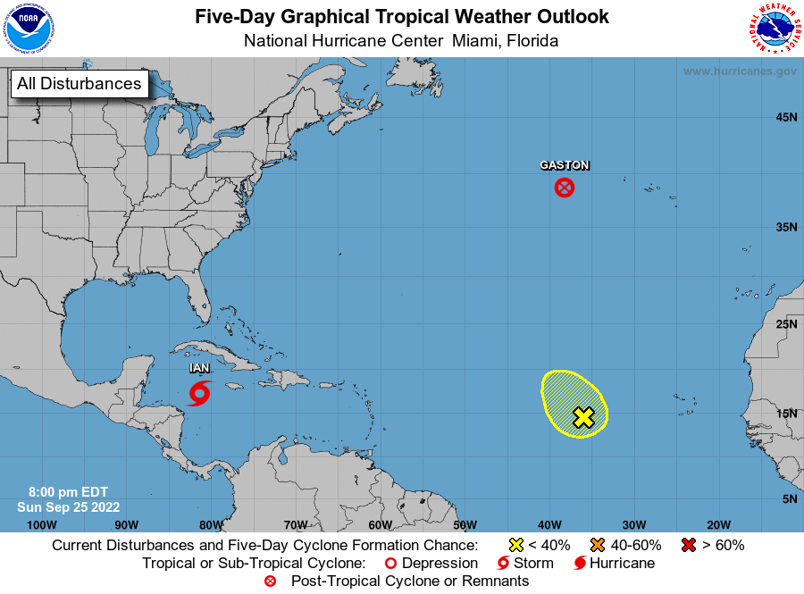
The National Hurricane Center is issuing advisories on Tropical
Storm Ian, located over the western Caribbean Sea, and on Tropical
Storm Gaston, located a few hundred miles west of the western
Azores.
1. Central Tropical Atlantic:
An area of low pressure located several hundred miles west of the
Cabo Verde Islands is producing persistent, but disorganized,
showers and thunderstorms. Some slow development of this system is
possible while it initially meanders for the next couple of days and
then moves slowly north-northwestward late this week.
* Formation chance through 48 hours...low...20 percent.
* Formation chance through 5 days...low...30 percent.
Forecaster D. Zelinsky