ZCZC MIATWOAT ALL
TTAA00 KNHC DDHHMM
Tropical Weather Outlook
NWS National Hurricane Center Miami FL
800 PM EDT Sat Sep 24 2022
For the North Atlantic...Caribbean Sea and the Gulf of Mexico:
Active Systems:
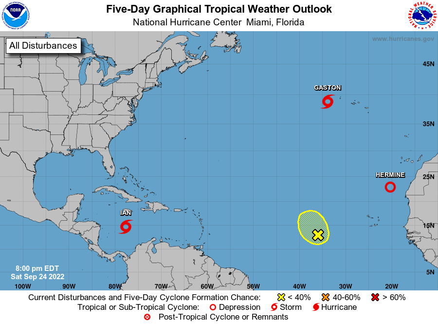
The National Hurricane Center is issuing advisories on Tropical
Storm Ian, located over the central Caribbean Sea, on Tropical Storm
Gaston, located near the western Azores, and on Tropical Depression
Hermine, located over the far eastern Atlantic. The National
Hurricane Center has issued its last advisory on Post-Tropical
Cyclone Fiona, centered near the southwest coast of Newfoundland,
Canada.
1. Central Tropical Atlantic:
An area of low pressure located several hundred miles west of the
Cabo Verde Islands is producing only limited shower activity. Any
development of this system should be slow to occur while it moves
very little through the early portion of next week. Environmental
conditions could become marginally more conducive for development by
the middle portion of next week, when the system is forecast to
begin moving slowly northward.
* Formation chance through 48 hours...low...10 percent.
* Formation chance through 5 days...low...20 percent.
Forecaster D. Zelinsky