ZCZC MIATWOAT ALL
TTAA00 KNHC DDHHMM
Tropical Weather Outlook
NWS National Hurricane Center Miami FL
200 AM EDT Mon Sep 19 2022
For the North Atlantic...Caribbean Sea and the Gulf of Mexico:
Active Systems:
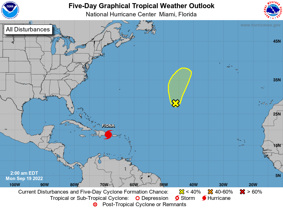
The National Hurricane Center is issuing advisories on Hurricane
Fiona, located between Puerto Rico and the Dominican Republic.
1. Central Subtropical Atlantic:
Satellite wind data from earlier tonight indicated an area of low
pressure has formed over the central subtropical Atlantic, and it is
producing disorganized showers and thunderstorms. There is a short
window for this system to develop further over the next day or two
before environmental conditions become less favorable later this
week. The system should move generally northward or northeastward
while remaining over the open central subtropical Atlantic.
* Formation chance through 48 hours...low...20 percent.
* Formation chance through 5 days...low...20 percent.
Forecaster Papin