ZCZC MIATWOAT ALL
TTAA00 KNHC DDHHMM
Tropical Weather Outlook
NWS National Hurricane Center Miami FL
200 AM EDT Fri Sep 16 2022
For the North Atlantic...Caribbean Sea and the Gulf of Mexico:
Active Systems:
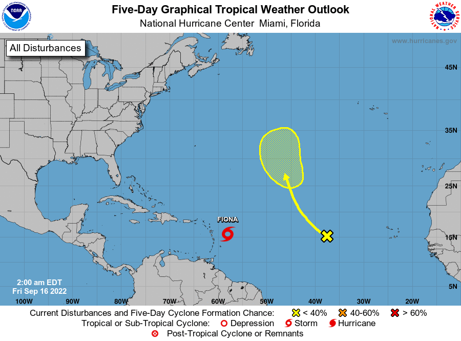
The National Hurricane Center is issuing advisories on Tropical
Storm Fiona, located a few hundred miles east-southeast of the
Leeward Islands.
1. Central Atlantic:
A tropical wave located roughly midway between the west coast of
Africa and the Lesser Antilles is producing limited and disorganized
shower activity. Some slow development of this system is possible
late this weekend and early next week while it moves northwestward
to northward over the central subtropical Atlantic.
* Formation chance through 48 hours...low...near 0 percent.
* Formation chance through 5 days...low...20 percent.
Forecaster Reinhart