ZCZC MIATWOAT ALL
TTAA00 KNHC DDHHMM
Tropical Weather Outlook
NWS National Hurricane Center Miami FL
200 AM EDT Mon Sep 12 2022
For the North Atlantic...Caribbean Sea and the Gulf of Mexico:
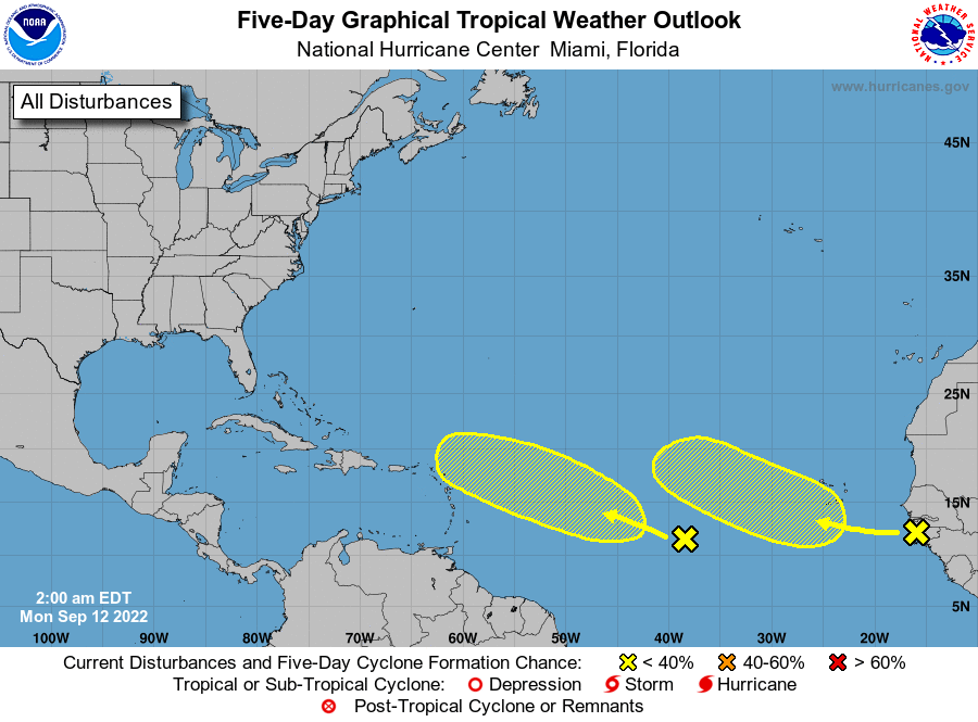
1. Eastern Tropical Atlantic:
A tropical wave currently moving off the west coast of Africa is
producing an area of disorganized showers and thunderstorms.
Environmental conditions appear only marginally favorable, and any
development of this wave should be slow to occur while it moves
westward or west-northwestward across the eastern tropical Atlantic
through the end of the week.
* Formation chance through 48 hours...low...near 0 percent.
* Formation chance through 5 days...low...20 percent.
2. Central Tropical Atlantic:
A tropical wave currently located more than 1000 miles east of the
Windward Islands is producing a large area of disorganized showers
and thunderstorms. Some gradual development of this system is
possible over the next several days as it moves generally westward
to west-northwestward over the central tropical Atlantic through the
end of the week.
* Formation chance through 48 hours...low...near 0 percent.
* Formation chance through 5 days...low...20 percent.
Forecaster Papin