ZCZC MIATWOAT ALL
TTAA00 KNHC DDHHMM
Tropical Weather Outlook
NWS National Hurricane Center Miami FL
200 AM EDT Tue Sep 6 2022
For the North Atlantic...Caribbean Sea and the Gulf of Mexico:
Active Systems:
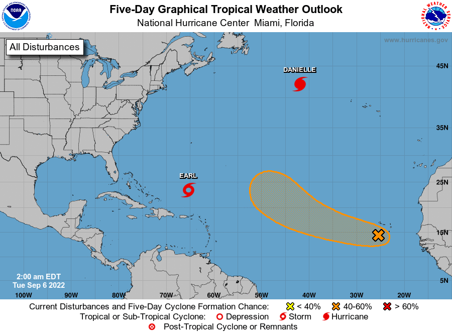
The National Hurricane Center is issuing advisories on Hurricane
Danielle, located about 850 miles west-northwest of the Azores, and
on Tropical Storm Earl, located about 650 miles south of Bermuda.
1. Eastern Tropical Atlantic:
Disorganized showers and thunderstorms stretching from the Cabo
Verde Islands southwestward several hundred miles are associated
with a broad and elongated area of low pressure. Environmental
conditions are conducive for some development of this system, and a
tropical depression could form in a few days while moving westward
to west-northwestward at 15 to 20 mph over the eastern and central
tropical Atlantic. Upper-level winds are likely to become less
conducive for development late this week.
* Formation chance through 48 hours...medium...40 percent.
* Formation chance through 5 days...medium...60 percent.
Forecaster Berg