ZCZC MIATWOAT ALL
TTAA00 KNHC DDHHMM
Tropical Weather Outlook
NWS National Hurricane Center Miami FL
800 PM EDT Mon Sep 5 2022
For the North Atlantic...Caribbean Sea and the Gulf of Mexico:
Active Systems:
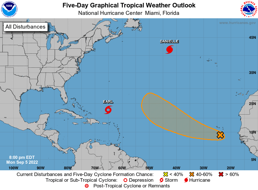
The National Hurricane Center is issuing advisories on Hurricane
Danielle, located about 900 miles west-northwest of the Azores, and
on Tropical Storm Earl, located about 700 miles south of Bermuda.
1. Eastern Tropical Atlantic:
A tropical wave near the Cabo Verde Islands continues to produce a
broad area of disorganized shower and thunderstorm activity. An area
of low pressure is forecast to form with this system in the next day
or so, and environmental conditions appear generally conducive for
additional development. A tropical depression could form by the
latter part of this week as the system moves generally
west-northwestward or northwestward over the eastern and central
tropical Atlantic.
* Formation chance through 48 hours...low...30 percent.
* Formation chance through 5 days...medium...60 percent.
Forecaster Pasch