ZCZC MIATWOAT ALL
TTAA00 KNHC DDHHMM
Tropical Weather Outlook
NWS National Hurricane Center Miami FL
800 AM EDT Sat Aug 20 2022
For the North Atlantic...Caribbean Sea and the Gulf of Mexico:
Active Systems:
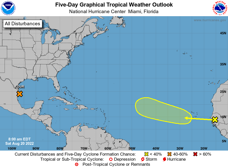
The National Hurricane Center is issuing advisories on Potential
Tropical Cyclone Four, located over the southwestern Gulf of Mexico.
* Formation chance through 48 hours...high...70 percent.
* Formation chance through 5 days...high...70 percent.
1. Eastern Tropical Atlantic:
A tropical wave is forecast to move off the west coast of Africa
later today and tonight. Environmental conditions are expected to
be marginally conducive for gradual development of this system
while it moves west-northwestward to northwestward at 15 to 20 mph
across the eastern and central tropical Atlantic during the early
to middle part of next week.
* Formation chance through 48 hours...low...near 0 percent.
* Formation chance through 5 days...low...20 percent.
Public Advisories on Potential Tropical Cyclone Four are issued
under WMO header WTNT34 KNHC and under AWIPS header MIATCPAT4.
Forecast/Advisories on Potential Tropical Cyclone Four are issued
under WMO header WTNT24 KNHC and under AWIPS header MIATCMAT4.
Forecaster Latto