ZCZC MIATWOAT ALL
TTAA00 KNHC DDHHMM
Tropical Weather Outlook
NWS National Hurricane Center Miami FL
800 AM EDT Fri Aug 19 2022
For the North Atlantic...Caribbean Sea and the Gulf of Mexico:
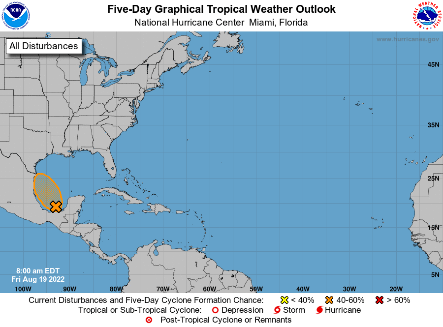
1. Southwestern Gulf of Mexico:
A broad area of low pressure located over the southwestern Gulf of
Mexico and the Bay of Campeche is producing poorly organized shower
activity. Environmental conditions appear favorable for slow
development, and a tropical depression could form late today or on
Saturday while the system moves northwestward across the
southwestern Gulf of Mexico. However, by Saturday night, the system
is expected to move inland over northeastern Mexico, which will end
its chances of development. An Air Force Reserve Hurricane Hunter
aircraft is scheduled to investigate the system later today, if
necessary.
* Formation chance through 48 hours...medium...40 percent.
* Formation chance through 5 days...medium...40 percent.
Forecaster Beven