ZCZC MIATWOAT ALL
TTAA00 KNHC DDHHMM
Tropical Weather Outlook
NWS National Hurricane Center Miami FL
800 PM EDT Thu Aug 18 2022
For the North Atlantic...Caribbean Sea and the Gulf of Mexico:
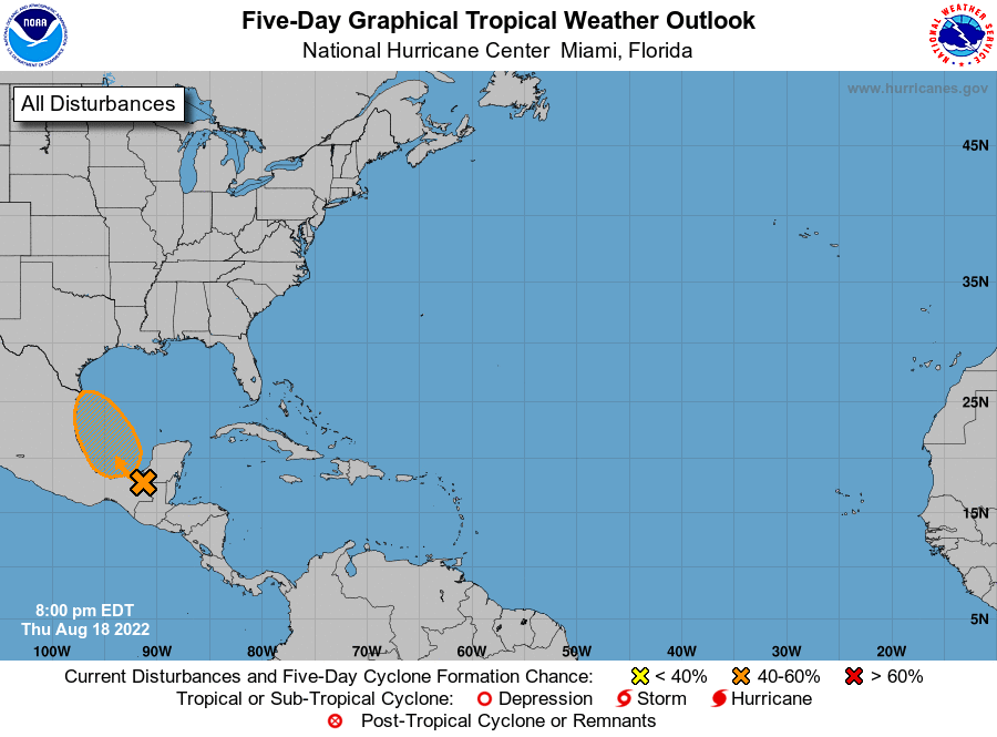
1. Southwestern Gulf of Mexico:
Scattered showers and thunderstorms are associated with a tropical
wave located over southeastern Mexico that is expected to emerge
into the Bay of Campeche tomorrow morning. Environmental conditions
appear favorable for additional development, and a tropical
depression could form while the system moves northwestward over the
southwestern Gulf of Mexico on Friday or Saturday. However, by
Saturday night, the system is expected to move inland over
northeastern Mexico, which will end its chances of development. An
Air Force Reserve Hurricane Hunter aircraft is scheduled to
investigate the system tomorrow, if necessary.
* Formation chance through 48 hours...medium...40 percent.
* Formation chance through 5 days...medium...40 percent.
Forecaster Flynn/Papin