Skip Navigation Links
NOAA NOAA United States Department of Commerce

NHC Graphical Outlook Archive


« Earliest Available         ‹ Earlier         Later ›         Latest Available »
GIS Shapefiles
Central Pacific Eastern Pacific Atlantic

View 2-Day Graphical Tropical Weather Outlook
Click for Eastern Pacific Click for Eastern Pacific

Tropical Weather Outlook Text

ZCZC MIATWOAT ALL
TTAA00 KNHC DDHHMM

Tropical Weather Outlook
NWS National Hurricane Center Miami FL
200 AM EDT Thu Aug 18 2022

For the North Atlantic...Caribbean Sea and the Gulf of Mexico:

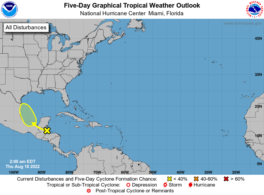
1. Southwestern Gulf of Mexico:
A concentrated area of showers and thunderstorms is associated with 
a tropical wave near the coast of Belize. This system is forecast to 
move across Central America and southeastern Mexico over the next 
day or so before emerging over the Bay of Campeche, where an area of 
low pressure could form on Friday. Some gradual development of this 
system is possible while it moves northwestward over the 
southwestern Gulf of Mexico through the weekend.
* Formation chance through 48 hours...low...20 percent.
* Formation chance through 5 days...low...30 percent.

Forecaster Papin


List of Atlantic Outlooks (May 2023 - present)
List of East Pacific Outlooks (May 2023 - present)
List of Central Pacific Outlooks (May 2023 - present)
List of Atlantic Outlooks (July 2014 - April 2023)
List of East Pacific Outlooks (July 2014 - April 2023)
List of Central Pacific Outlooks (June 2019 - April 2023)
List of Atlantic Outlooks (June 2009 - June 2014)
List of East Pacific Outlooks (June 2009 - June 2014)