ZCZC MIATWOAT ALL
TTAA00 KNHC DDHHMM
Tropical Weather Outlook
NWS National Hurricane Center Miami FL
200 AM EDT Tue Aug 9 2022
For the North Atlantic...Caribbean Sea and the Gulf of Mexico:
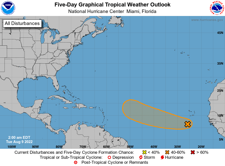
1. Eastern Tropical Atlantic:
A tropical wave continues to produce a large area of disorganized
cloudiness and thunderstorms over the eastern tropical Atlantic a
few hundred miles south-southwest of the Cabo Verde Islands.
Gradual development of this system is possible and a tropical
depression could form around the middle to latter portion of the
week before environmental conditions become less favorable by this
weekend. This system is expected to move westward to
west-northwestward at 15 to 20 mph across the tropical Atlantic
during the next several days.
* Formation chance through 48 hours...low...20 percent.
* Formation chance through 5 days...medium...40 percent.
Forecaster Brown