ZCZC MIATWOAT ALL
TTAA00 KNHC DDHHMM
Tropical Weather Outlook
NWS National Hurricane Center Miami FL
200 AM EDT Fri Jul 1 2022
For the North Atlantic...Caribbean Sea and the Gulf of Mexico:
Active Systems:
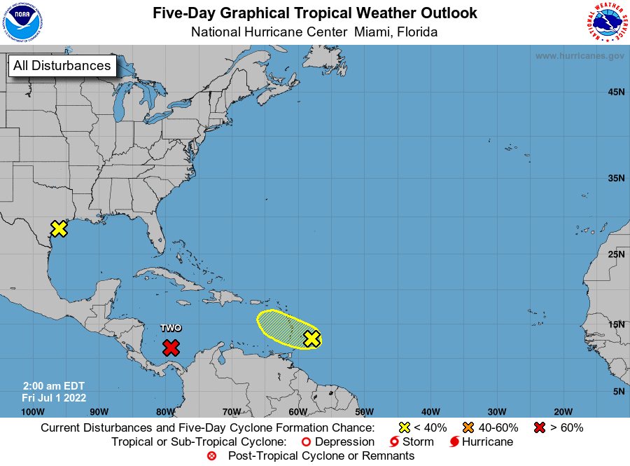
The National Hurricane Center is issuing advisories on Potential
Tropical Cyclone Two, located over the southwestern Caribbean Sea.
* Formation chance through 48 hours...high...90 percent.
* Formation chance through 5 days...high...90 percent.
1. Western Gulf of Mexico:
Satellite imagery and surface observations indicate that the area of
low pressure in the far western Gulf of Mexico has degenerated into
a surface trough and is now moving inland along the southern Texas
coast. Development of this system is no longer anticipated as it
moves farther inland. Regardless, heavy rain and associated flooding
are possible over portions of southeast Texas. For more on the
potential for heavy rain and flooding, please see products issued by
your National Weather Service office.
* Formation chance through 48 hours...low...near 0 percent.
* Formation chance through 5 days...low...near 0 percent.
2. Western Tropical Atlantic:
A tropical wave located a few hundred miles east of the Windward
Islands is producing disorganized showers and thunderstorms. Any
development of this system should be slow to occur while the wave
moves west-northwestward during the next day or two. The wave is
forecast to move over the Windward Islands today and then over the
eastern Caribbean Sea by the weekend, where further development is
unlikely due to unfavorable environmental conditions.
* Formation chance through 48 hours...low...10 percent.
* Formation chance through 5 days...low...10 percent.
Forecaster Papin