ZCZC MIATWOAT ALL
TTAA00 KNHC DDHHMM
Tropical Weather Outlook
NWS National Hurricane Center Miami FL
800 AM EDT Sat Jun 25 2022
For the North Atlantic...Caribbean Sea and the Gulf of Mexico:
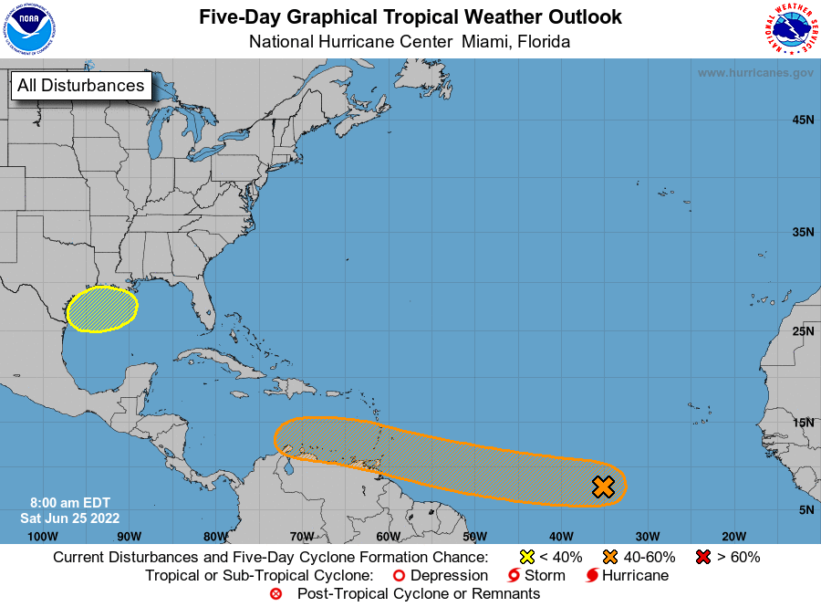
1. Tropical Atlantic:
Cloudiness and showers have become a little more concentrated near a
tropical wave located over the central tropical Atlantic Ocean.
Environmental conditions appear conducive for development of this
system over the next few days, and a tropical depression could form
during the early to middle part of next week. This system is
forecast to move westward at 15 to 20 mph over the tropical
Atlantic, approach the Windward Islands on Tuesday, and move into
the southeastern Caribbean Sea by Wednesday.
* Formation chance through 48 hours...low...30 percent.
* Formation chance through 5 days...medium...60 percent.
2. Northwestern Gulf of Mexico:
An area of low pressure could form early next week over the
northern Gulf of Mexico. Any development of this system would
likely be slow to occur as it drifts westward toward the
northwestern Gulf of Mexico.
* Formation chance through 48 hours...low...near 0 percent.
* Formation chance through 5 days...low...20 percent.
Forecaster Berg