Skip Navigation Links
NOAA NOAA United States Department of Commerce

NHC Graphical Outlook Archive


« Earliest Available         ‹ Earlier         Later ›         Latest Available »
GIS Shapefiles
Central Pacific Eastern Pacific Atlantic

View 2-Day Graphical Tropical Weather Outlook
Click for Eastern Pacific Click for Eastern Pacific

Tropical Weather Outlook Text

ZCZC MIATWOAT ALL
TTAA00 KNHC DDHHMM

Tropical Weather Outlook
NWS National Hurricane Center Miami FL
200 AM EDT Sat Jun 18 2022

For the North Atlantic...Caribbean Sea and the Gulf of Mexico:

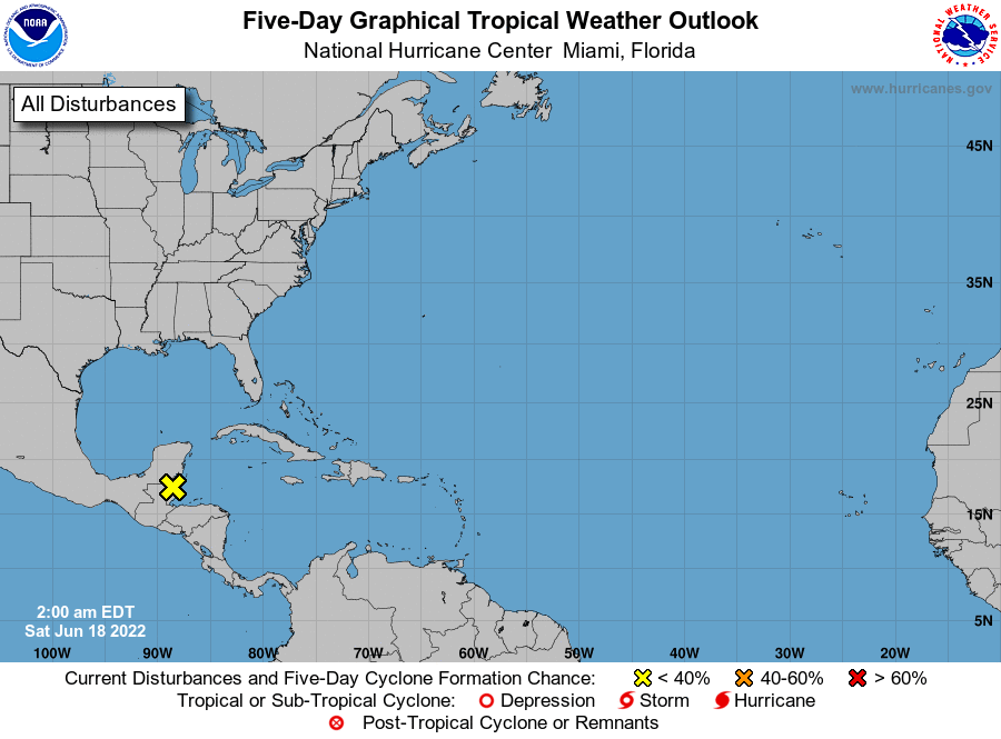
1. Northwestern Caribbean Sea:
A trough of low pressure located over Belize and the eastern part 
of the Yucatan Peninsula is producing disorganized showers and 
thunderstorms over northern Central America and southeastern 
Mexico.  The system is expected to remain inland through 
the weekend, and development is not anticipated.  However, locally 
heavy rainfall is still possible over Honduras, Belize, northern 
Guatemala, and southeastern Mexico through the weekend.
* Formation chance through 48 hours...low...near 0 percent.
* Formation chance through 5 days...low...near 0 percent.

Forecaster Roberts


List of Atlantic Outlooks (May 2023 - present)
List of East Pacific Outlooks (May 2023 - present)
List of Central Pacific Outlooks (May 2023 - present)
List of Atlantic Outlooks (July 2014 - April 2023)
List of East Pacific Outlooks (July 2014 - April 2023)
List of Central Pacific Outlooks (June 2019 - April 2023)
List of Atlantic Outlooks (June 2009 - June 2014)
List of East Pacific Outlooks (June 2009 - June 2014)