ZCZC MIATWOAT ALL
TTAA00 KNHC DDHHMM
Tropical Weather Outlook
NWS National Hurricane Center Miami FL
800 PM EDT Tue Jun 14 2022
For the North Atlantic...Caribbean Sea and the Gulf of Mexico:
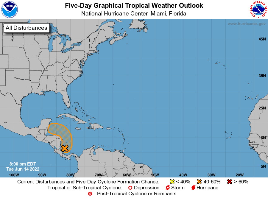
1. Southwestern Caribbean Sea:
Satellite imagery and surface observations indicate that a small
area of low pressure has formed in the far southwestern Caribbean
Sea, accompanied by disorganized showers and thunderstorms. Further
development of this system is possible while it drifts northwestward
near the coasts of Nicaragua and Honduras, and it could become a
tropical depression later this week if the disturbance remains over
water. An Air Force Reserve Hurricane Hunter aircraft is scheduled
to investigate this system tomorrow if necessary. Regardless of
development, the low could produce periods of heavy rainfall across
portions of eastern Nicaragua and eastern Honduras through late this
week.
* Formation chance through 48 hours...low...30 percent.
* Formation chance through 5 days...medium...40 percent.
Forecaster Hogsett/Pasch