ZCZC MIATWOAT ALL
TTAA00 KNHC DDHHMM
Tropical Weather Outlook
NWS National Hurricane Center Miami FL
200 AM EDT Tue Jun 14 2022
For the North Atlantic...Caribbean Sea and the Gulf of Mexico:
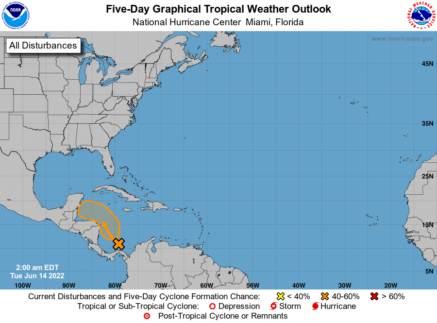
1. Southwestern Caribbean Sea:
Disorganized showers and thunderstorms over the southwestern
Caribbean Sea are associated with a trough of low pressure.
Gradual development of this system is possible while it
drifts northwestward near the coasts of Nicaragua and Honduras, and
it could become a tropical depression late this week if the
disturbance remains over water. Regardless of development, this
system could produce periods of heavy rainfall across portions of
eastern Nicaragua and eastern Honduras late this week.
* Formation chance through 48 hours...low...10 percent.
* Formation chance through 5 days...medium...40 percent.
Forecaster Cangialosi