ZCZC MIATWOAT ALL
TTAA00 KNHC DDHHMM
Tropical Weather Outlook
NWS National Hurricane Center Miami FL
800 PM EDT Tue May 31 2022
For the North Atlantic...Caribbean Sea and the Gulf of Mexico:
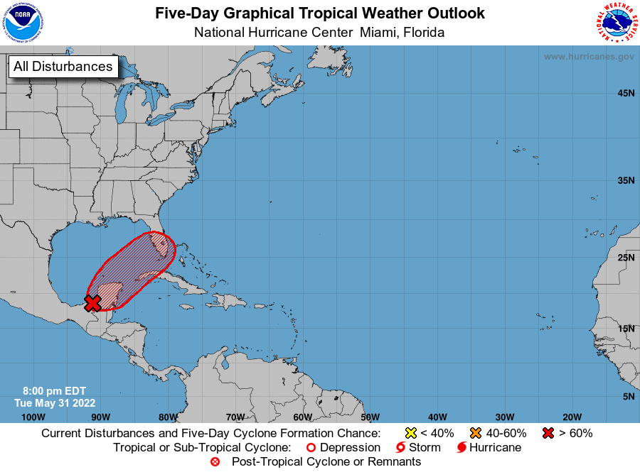
1. Near the Yucatan Peninsula and Southeastern Gulf of Mexico:
A large area of disturbed weather has developed near the Yucatan
Peninsula, partially related to the remnants of Agatha interacting
with an upper-level trough over the Gulf of Mexico. Despite this
marginal environment, this system is likely to become a tropical
depression by Friday as it moves northeastward across the Yucatan
Peninsula, the northwestern Caribbean Sea, and southeastern Gulf of
Mexico. Regardless of development, locally heavy rainfall is likely
across portions of southeastern Mexico, the Yucatan Peninsula,
Guatemala, and Belize during the next couple of days, spreading
across western Cuba, southern Florida, and the Florida Keys on
Friday and Saturday. Interests in the Yucatan Peninsula, western
Cuba, the Florida Keys and the Florida Peninsula should monitor the
progress of this system.
* Formation chance through 48 hours...medium...40 percent.
* Formation chance through 5 days...high...70 percent.
Forecaster Papin