ZCZC MIATWOAT ALL
TTAA00 KNHC DDHHMM
Tropical Weather Outlook
NWS National Hurricane Center Miami FL
800 PM EDT Mon May 30 2022
For the North Atlantic...Caribbean Sea and the Gulf of Mexico:
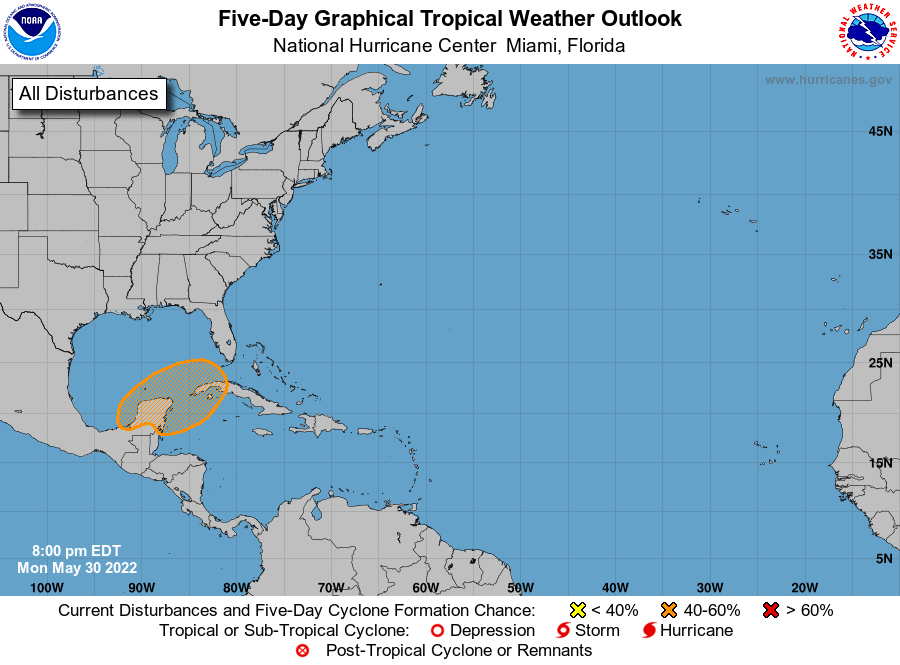
1. Near the Yucatan Peninsula:
A large and complex area of low pressure is expected to develop near
the Yucatan Peninsula and the northwestern Caribbean Sea in a couple
of days, partially related to the remnants of Hurricane Agatha from
the eastern Pacific. Thereafter, this system is forecast to move
slowly northeastward, and a tropical depression could form in the
northwestern Caribbean or southeastern Gulf of Mexico by the latter
part of this week. Regardless of development, locally heavy
rainfall is likely across portions of southern Mexico, the Yucatan
Peninsula, Guatemala, Belize, and western Cuba through the week.
* Formation chance through 48 hours...low...near 0 percent.
* Formation chance through 5 days...medium...50 percent.
Forecaster Papin