ZCZC MIATWOAT ALL
TTAA00 KNHC DDHHMM
Tropical Weather Outlook
NWS National Hurricane Center Miami FL
700 AM EST Thu Nov 11 2021
For the North Atlantic...Caribbean Sea and the Gulf of Mexico:
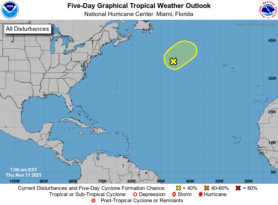
1. Showers and thunderstorms associated with a storm-force non-tropical
area of low pressure located more than 1000 miles east-northeast of
Bermuda have changed little in organization since last night.
Although there is still a small chance the system could become a
short-lived subtropical storm today, the system is quickly moving
over cooler waters and the likelihood of subtropical development has
decreased. By this weekend, the system is expected to be absorbed by
a larger non-tropical low. Additional information on this system,
including hurricane-force wind warnings, can be found in High Seas
forecasts issued by the National Weather Service.
* Formation chance through 48 hours...low...30 percent.
* Formation chance through 5 days...low...30 percent.
High Seas Forecasts issued by the National Weather Service can be
found under AWIPS header NFDHSFAT1, WMO header FZNT01 KWBC, and
online at ocean.weather.gov/shtml/NFDHSFAT1.php
Forecaster D. Zelinsky