ZCZC MIATWOAT ALL
TTAA00 KNHC DDHHMM
Tropical Weather Outlook
NWS National Hurricane Center Miami FL
100 PM EST Sun Nov 7 2021
For the North Atlantic...Caribbean Sea and the Gulf of Mexico:
The National Hurricane Center has issued the final advisory on
Post-Tropical Cyclone Wanda, located several hundred miles
west-northwest of the Azores.
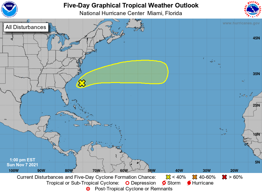
1. A non-tropical low pressure system with storm-force winds is located
about 200 miles south of Cape Hatteras, North Carolina. This system
is forecast to move east-northeastward over the next few days and
could gradually acquire some subtropical characteristics as it moves
across the subtropical Atlantic ocean along the warm Gulf Stream
current. For more information on this system, including storm and
coastal flood warnings, see products issued by your local National
Weather Service office and High Seas Forecasts issued by the
National Weather Service.
* Formation chance through 48 hours...low...10 percent.
* Formation chance through 5 days...low...20 percent.
High Seas Forecasts issued by the National Weather Service
can be found under AWIPS header NFDHSFAT1, WMO header FZNT01
KWBC, and online at ocean.weather.gov/shtml/NFDHSFAT1.php
Forecaster Papin