ZCZC MIATWOAT ALL
TTAA00 KNHC DDHHMM
Tropical Weather Outlook
NWS National Hurricane Center Miami FL
800 PM EDT Wed Oct 27 2021
For the North Atlantic...Caribbean Sea and the Gulf of Mexico:
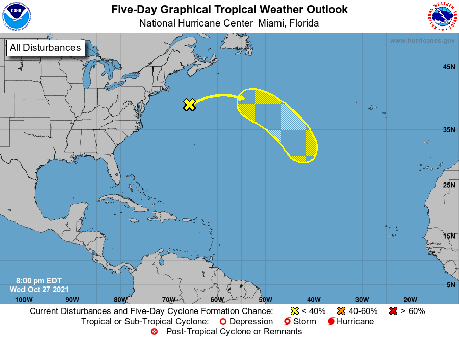
1. A deep, non-tropical low pressure system producing storm-force
winds is located about 275 miles southeast of Nantucket,
Massachusetts. Strong winds along portions of the northeastern
United States coast are forecast to gradually diminish overnight and
on Thursday as the low moves eastward away from shore at about 15
mph. The low is then expected to turn southeastward toward
slightly warmer waters in a few days, and it could acquire some
subtropical characteristics over the weekend or early next week
while over the central Atlantic. For more information on this
system, including storm warnings, see products issued by your local
National Weather Service office and High Seas Forecasts issued by
the National Weather Service.
* Formation chance through 48 hours...low...10 percent.
* Formation chance through 5 days...low...30 percent.
High Seas Forecasts issued by the National Weather Service can be
found under AWIPS header NFDHSFAT1, WMO header FZNT01 KWBC, and
online at ocean.weather.gov/shtml/NFDHSFAT1.php
Forecaster Berg