ZCZC MIATWOAT ALL
TTAA00 KNHC DDHHMM
Tropical Weather Outlook
NWS National Hurricane Center Miami FL
800 PM EDT Wed Oct 6 2021
For the North Atlantic...Caribbean Sea and the Gulf of Mexico:
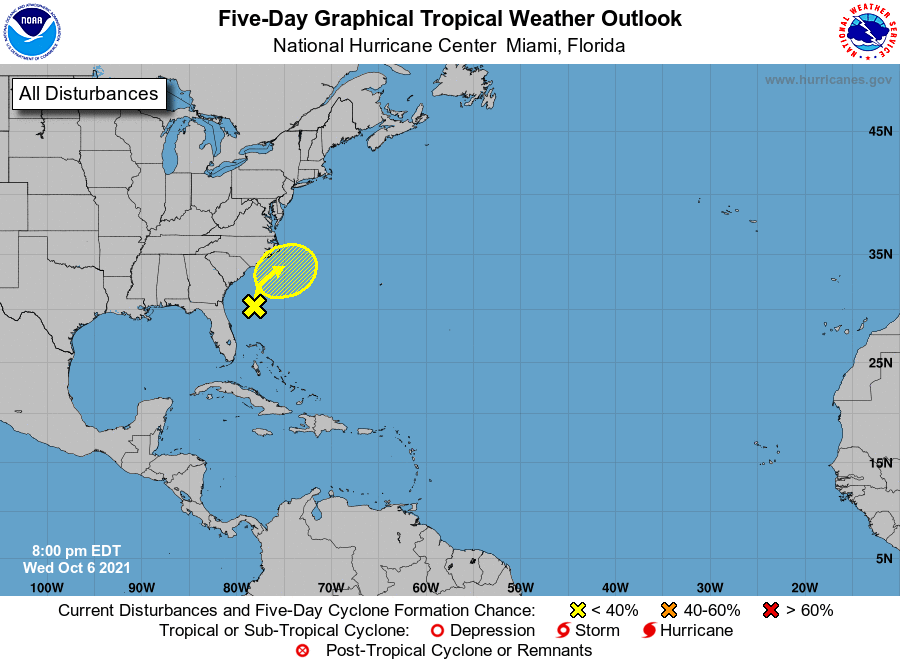
1. A weak area of low pressure located a couple of hundred miles off
the coast of northeastern Florida continues to produce disorganized
shower activity. The low is expected to move northward and then
northeastward at 5 to 10 mph off the southeastern coast of the
United States during the next few days, and upper-level winds are
expected to remain too strong for significant development. By the
weekend, the system is forecast to interact with a front, which
could also limit tropical development. Regardless of development,
this system could bring gusty winds and locally heavy rain to
portions of the Carolinas late this week and this weekend.
* Formation chance through 48 hours...low...10 percent.
* Formation chance through 5 days...low...20 percent.
Forecaster Cangialosi