ZCZC MIATWOAT ALL
TTAA00 KNHC DDHHMM CCA
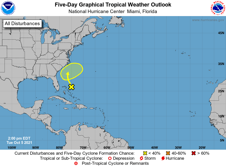
Tropical Weather Outlook...Corrected
NWS National Hurricane Center Miami FL
Issued by the NWS Weather Prediction Center College Park MD
200 PM EDT Tue Oct 5 2021
For the North Atlantic...Caribbean Sea and the Gulf of Mexico:
1. A large area of disorganized showers and thunderstorms is located
east of a surface trough extending from the central Bahamas
northward over the adjacent southwestern Atlantic waters.
Upper-level winds are not expected to be favorable for significant
tropical development of this system while it moves slowly
northwestward over the next several days. By this weekend, the
system is forecast to interact with a front near the coast of the
southeastern United States.
* Formation chance through 48 hours...low...near 0 percent.
* Formation chance through 5 days...low...10 percent.
Forecaster Brown