ZCZC MIATWOAT ALL
TTAA00 KNHC DDHHMM
Tropical Weather Outlook
NWS National Hurricane Center Miami FL
200 AM EDT Sat Sep 25 2021
For the North Atlantic...Caribbean Sea and the Gulf of Mexico:
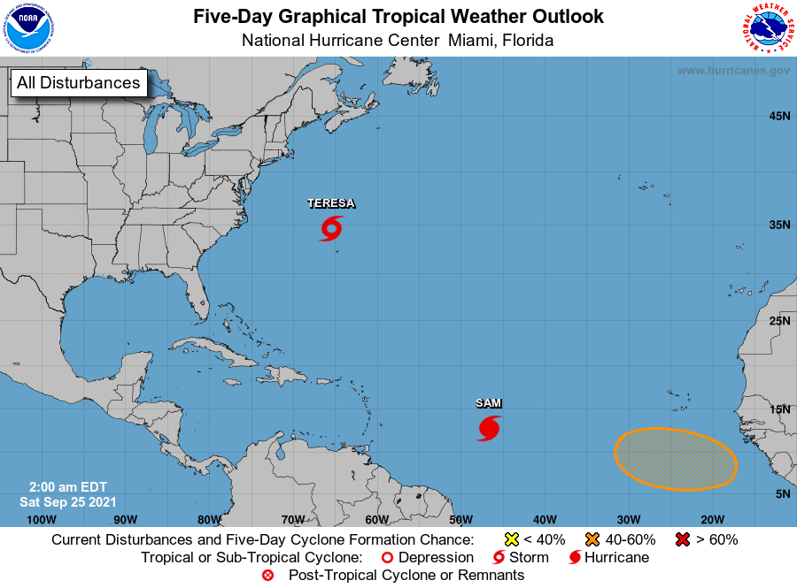
The National Hurricane Center is issuing advisories on Hurricane
Sam, located about 1200 miles east-southeast of the northern
Leeward Islands, and on Subtropical Storm Teresa, located about 150
miles north-northwest of Bermuda.
1. A tropical wave is expected to move off the west coast of Africa in
a couple of days. Thereafter, environmental conditions are forecast
to be conducive for gradual development, and a tropical depression
could form by the middle of next week while the system moves
westward at 10 to 15 mph over the far eastern tropical Atlantic.
* Formation chance through 48 hours...low...near 0 percent.
* Formation chance through 5 days...medium...50 percent.
Public Advisories on Subtropical Storm Teresa are issued under WMO
header WTNT34 KNHC and under AWIPS header MIATCPAT4.
Forecast/Advisories on Subtropical Storm Teresa are issued under
WMO header WTNT24 KNHC and under AWIPS header MIATCMAT4.
Forecaster Cangialosi