ZCZC MIATWOAT ALL
TTAA00 KNHC DDHHMM
Tropical Weather Outlook
NWS National Hurricane Center Miami FL
800 PM EDT Fri Sep 17 2021
For the North Atlantic...Caribbean Sea and the Gulf of Mexico:
The National Hurricane Center is issuing advisories on newly formed
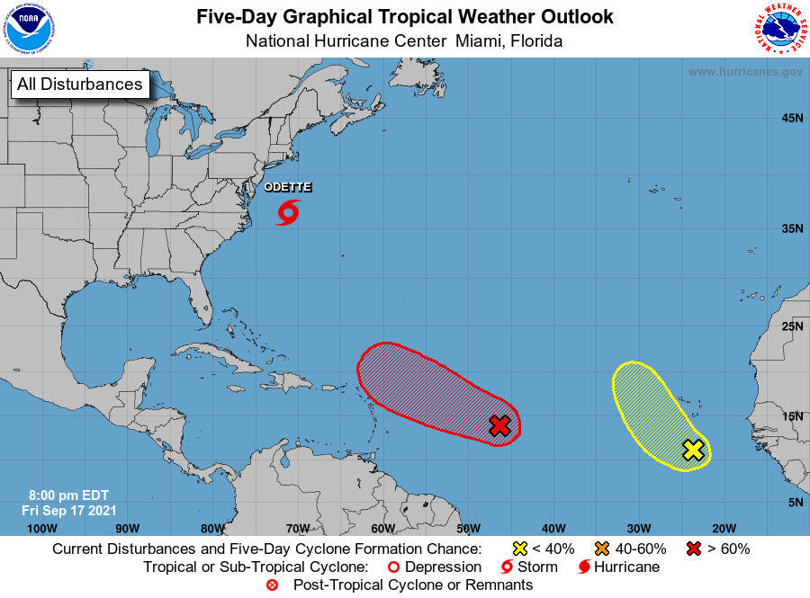
Tropical Storm Odette, located a couple of hundred miles off the
Mid-Atlantic U.S. coast.
The Weather Prediction Center has issued the last advisory on
Post-Tropical Cyclone Nicholas, located over Louisiana.
1. Showers and thunderstorms are gradually becoming better organized in
association with an area of low pressure located about 1100 miles
east-southeast of the northern Leeward Islands. Environmental
conditions are expected to be conducive for further development
during the next couple of days, and a tropical depression is likely
to form during the next day or two while the system moves toward the
west-northwest at about 15 mph. This system is expected to be near
the northern Leeward Islands on Monday and Tuesday, and interests
there should monitor the progress of this disturbance. Upper-level
winds are likely to become less conducive for development when the
system reaches the southwestern Atlantic by the early to middle part
of next week.
* Formation chance through 48 hours...high...80 percent.
* Formation chance through 5 days...high...80 percent.
2. A broad area of low pressure located a few hundred miles south of
the Cabo Verde Islands continues to produce disorganized showers and
thunderstorms. This system is expected to move toward the west and
then northwest at 5 to 10 mph over the far eastern Atlantic, and
some gradual development is possible over the weekend. However, by
early next week, further development appears unlikely as the system
is expected to move into strong upper-level winds and over cooler
waters.
* Formation chance through 48 hours...low...20 percent.
* Formation chance through 5 days...low...30 percent.
Public Advisories on Tropical Storm Odette are issued under
WMO header WTNT35 KNHC and under AWIPS header MIATCPAT5.
Forecast/Advisories on Tropical Storm Odette are issued under
WMO header WTNT25 KNHC and under AWIPS header MIATCMAT5.
Forecaster Cangialosi