ZCZC MIATWOAT ALL
TTAA00 KNHC DDHHMM
Tropical Weather Outlook
NWS National Hurricane Center Miami FL
800 AM EDT Tue Sep 7 2021
For the North Atlantic...Caribbean Sea and the Gulf of Mexico:
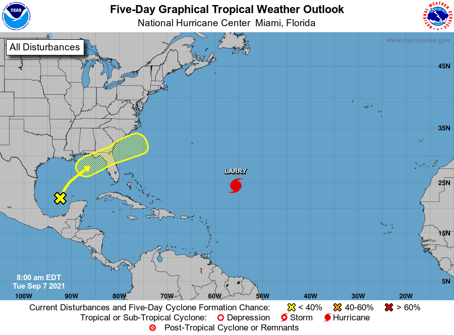
The National Hurricane Center is issuing advisories on Hurricane
Larry, located over the central Atlantic about 850 miles southeast
of Bermuda.
1. Disorganized showers and thunderstorms over the south-central Gulf
of Mexico are associated with a surface trough and an upper-level
disturbance. The system is expected to move slowly northeastward
over the central and northeastern Gulf of Mexico during the next
couple of days. Upper-level winds are currently unfavorable for
development, but they are forecast to become marginally conducive
for some limited development as the system nears the northern Gulf
coast on Wednesday and Wednesday night. The disturbance is then
expected to cross the southeastern United States, and some tropical
or subtropical development will be possible after it emerges off the
southeastern United States coast late this week.
* Formation chance through 48 hours...low...10 percent.
* Formation chance through 5 days...low...30 percent.
Forecaster Latto