ZCZC MIATWOAT ALL
TTAA00 KNHC DDHHMM
Tropical Weather Outlook
NWS National Hurricane Center Miami FL
200 AM EDT Sun Sep 5 2021
For the North Atlantic...Caribbean Sea and the Gulf of Mexico:
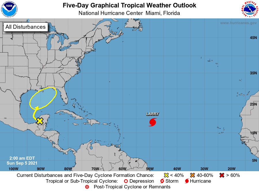
The National Hurricane Center is issuing advisories on Hurricane
Larry, located over the central tropical Atlantic about 900 miles
east of the Leeward Islands.
1. Disorganized showers and thunderstorms over portions of Central
America and the Yucatan Peninsula are associated with a surface
trough and an upper-level disturbance. Locally heavy rains are
likely to continue today over that area. The system is forecast to
move northwestward over the southwestern Gulf of Mexico later today,
then move slowly northward or northeastward over the western or
central Gulf of Mexico. Upper-level winds are only expected to be
marginally conducive for tropical cyclone formation, but some slow
development is possible while the system moves across the Gulf of
Mexico through the middle of the week.
* Formation chance through 48 hours...low...near 0 percent.
* Formation chance through 5 days...low...30 percent.
Forecaster Cangialosi