ZCZC MIATWOAT ALL
TTAA00 KNHC DDHHMM
Tropical Weather Outlook
NWS National Hurricane Center Miami FL
800 PM EDT Sat Sep 4 2021
For the North Atlantic...Caribbean Sea and the Gulf of Mexico:
The National Hurricane Center is issuing advisories on Hurricane
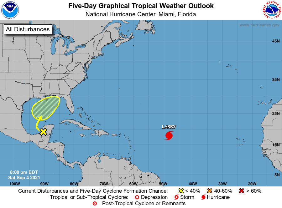
Larry, located over the central tropical Atlantic less than 1000
miles east of the Leeward Islands.
1. A weak surface trough over portions of the western Yucatan Peninsula
of Mexico interacting with an upper-level trough located over the
Bay of Campeche is producing disorganized showers and thunderstorms.
The disturbance is forecast to move northwestward over the
southwestern Gulf of Mexico on Sunday, then move slowly northward
or northeastward over the western or central Gulf of Mexico Monday
and Tuesday. Upper-level winds are only expected to be marginally
conducive for development of this system through Wednesday,
followed by unfavorable environmental conditions thereafter.
Regardless of development, locally heavy rains are possible over
portions of the Yucatan Peninsula and northern Central America
through Sunday.
* Formation chance through 48 hours...low...near 0 percent.
* Formation chance through 5 days...low...30 percent.
Forecaster Stewart