ZCZC MIATWOAT ALL
TTAA00 KNHC DDHHMM
Tropical Weather Outlook
NWS National Hurricane Center Miami FL
200 PM EDT Fri Sep 3 2021
For the North Atlantic...Caribbean Sea and the Gulf of Mexico:
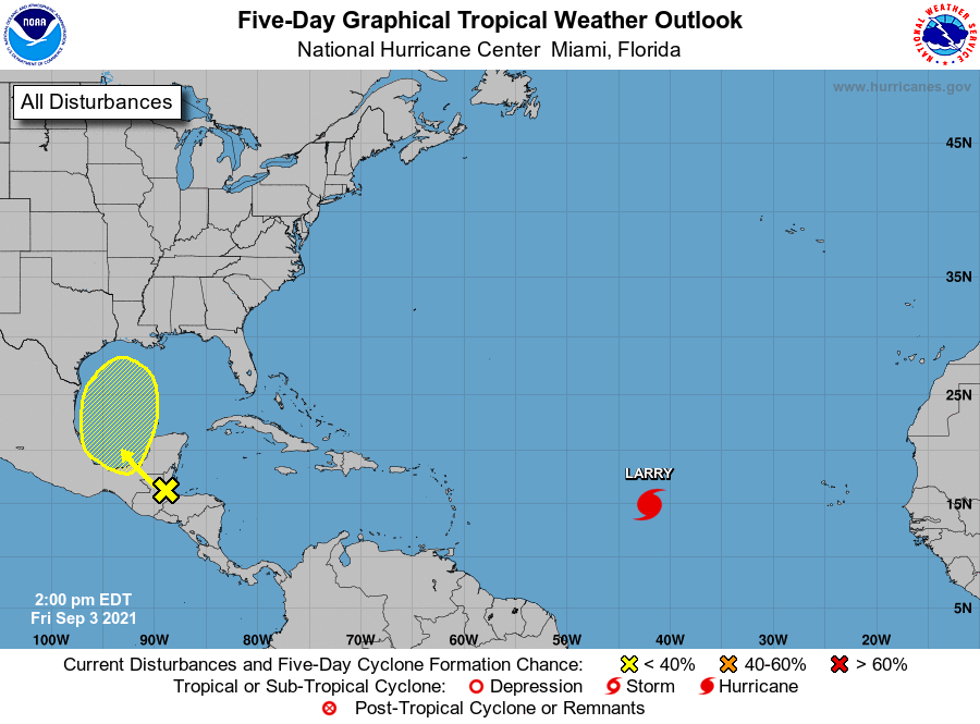
The National Hurricane Center is issuing advisories on Hurricane
Larry, located over the eastern tropical Atlantic about 1100 miles
west of the southernmost Cabo Verde Islands.
1. A surface trough over portions of Central America and the
southern Yucatan Peninsula of Mexico is producing disorganized
shower and thunderstorm activity. This system is expected to move
west-northwestward during the next day or two, bringing locally
heavy rains to these areas. The disturbance is expected to move
over the southwestern Gulf of Mexico late this weekend, and then
move northwestward to northward over the western Gulf of Mexico
early next week. However, unfavorable upper-level winds could limit
significant development during that time.
* Formation chance through 48 hours...low...near 0 percent.
* Formation chance through 5 days...low...30 percent.
Forecaster Beven