ZCZC MIATWOAT ALL
TTAA00 KNHC DDHHMM
Tropical Weather Outlook
NWS National Hurricane Center Miami FL
200 AM EDT Sat Aug 21 2021
For the North Atlantic...Caribbean Sea and the Gulf of Mexico:
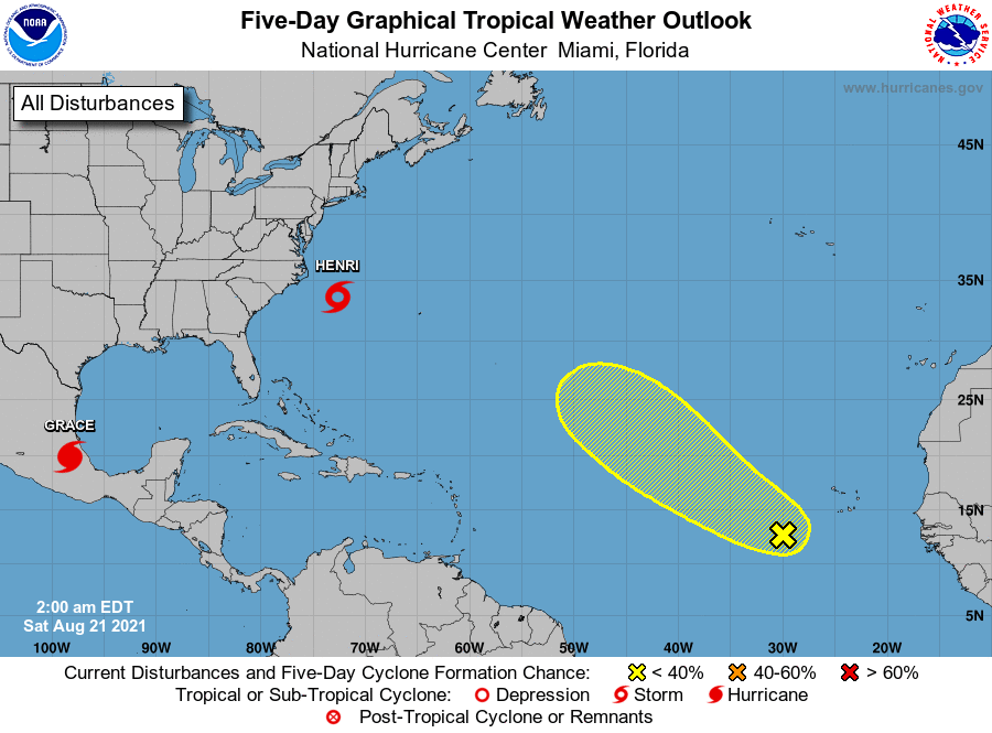
The National Hurricane Center is issuing advisories on Hurricane
Grace, located over the extreme southwestern Gulf of Mexico near the
coast of mainland Mexico, and on Tropical Storm Henri, located a
couple of hundred miles south-southeast of Cape Hatteras, North
Carolina.
1. A tropical wave located over the eastern Atlantic several hundred
miles to the southwest of the Cabo Verde Islands is producing a
broad area of disorganized showers and thunderstorms. This wave is
expected to interact with another wave over the far eastern Atlantic
in a day or two. Afterwards, environmental conditions appear
marginally favorable for some slow development by the beginning of
next week as this system moves gradually to the northwest at 5 to 10
mph.
* Formation chance through 48 hours...low...near 0 percent.
* Formation chance through 5 days...low...20 percent.
Forecaster Brown