ZCZC MIATWOAT ALL
TTAA00 KNHC DDHHMM
Tropical Weather Outlook
NWS National Hurricane Center Miami FL
200 PM EDT Sun Aug 15 2021
For the North Atlantic...Caribbean Sea and the Gulf of Mexico:
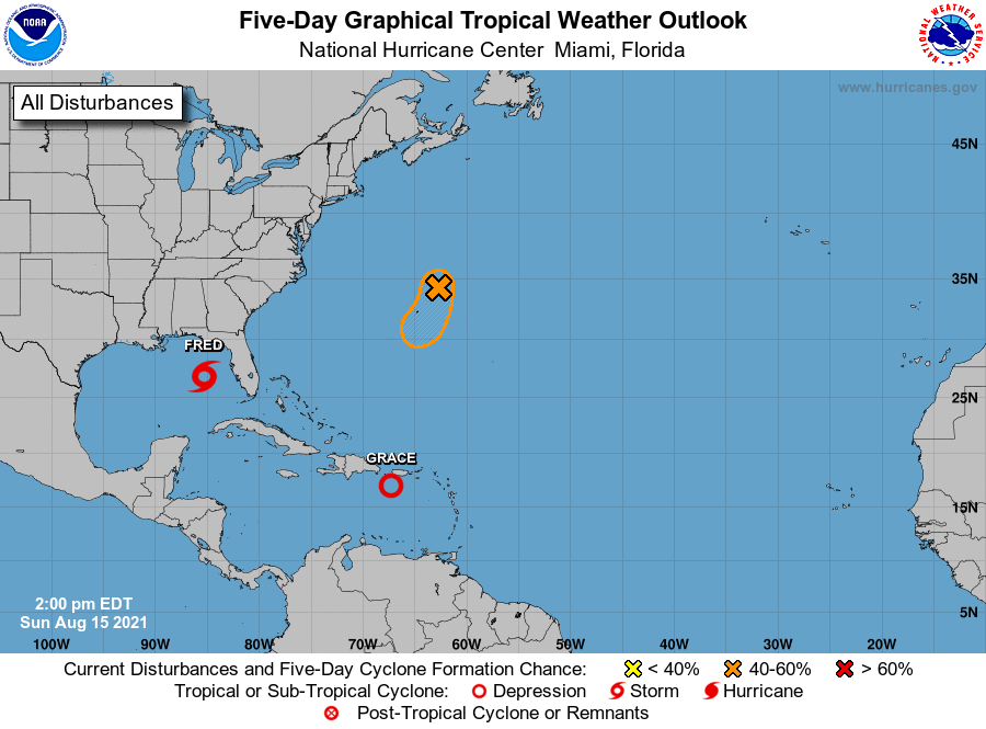
The National Hurricane Center is issuing advisories on recently
re-designated Tropical Storm Fred, located over the east-central
Gulf of Mexico, and on Tropical Storm Grace, located over the
northeastern Caribbean Sea just to the south of Puerto Rico.
1. A small but well-defined low pressure system located about 175
miles northeast of Bermuda continues to produce disorganized
shower and thunderstorm activity. Environmental conditions appear
conducive for some development of this low during the next couple
of days, and a tropical depression could form while it moves slowly
to the south or south-southwest at about 5 mph, near or to the east
of Bermuda. By Tuesday, upper-level winds are forecast to become
less conducive for tropical cyclone formation. Interests in Bermuda
should monitor the progress of this system during the next few days.
* Formation chance through 48 hours...medium...40 percent.
* Formation chance through 5 days...medium...40 percent.
Forecaster Berg